Sixty Years Of Exploration, Innovation, And Discovery!
Sixty Years of Exploration, Innovation, and Discovery!

Exactly sixty years ago today, we opened our doors for the first time. And since then, we have opened up a universe of discovery and innovation.
There are so many achievements to celebrate from the past six decades, there’s no way we can go through all of them. If you want to dive deeper into our history of exploration, check out NASA: 60 Years and Counting.
In the meantime, take a moonwalk down memory lane with us while we remember a few of our most important accomplishments from the past sixty years!

In 1958, President Eisenhower signed the National Aeronautics and Space Act, which effectively created our agency. We officially opened for business on October 1.
To learn more about the start of our space program, watch our video: How It All Began.

Alongside the U.S. Air Force, we implemented the X-15 hypersonic aircraft during the 1950s and 1960s to improve aircraft and spacecraft.
The X-15 is capable of speeds exceeding Mach 6 (4,500 mph) at altitudes of 67 miles, reaching the very edge of space.
Dubbed the “finest and most productive research aircraft ever seen,” the X-15 was officially retired on October 24, 1968. The information collected by the X-15 contributed to the development of the Mercury, Gemini, Apollo, and Space Shuttle programs.
To learn more about how we have revolutionized aeronautics, watch our Leading Edge of Flight video.

On July 20, 1969, Neil Armstrong and Buzz Aldrin became the first humans to walk on the moon. The crew of Apollo 11 had the distinction of completing the first return of soil and rock samples from beyond Earth.
Astronaut Gene Cernan, during Apollo 17, was the last person to have walked on the surface of the moon. (For now!)
The Lunar Roving Vehicle was a battery-powered rover that the astronauts used during the last three Apollo missions.
To learn more about other types of technology that we have either invented or improved, watch our video: Trailblazing Technology.

Our long-term Earth-observing satellite program began on July 23, 1972 with the launch of Landsat 1, the first in a long series (Landsat 9 is expected to launch in 2020!) We work directly with the U.S. Geological Survey to use Landsat to monitor and manage resources such as food, water, and forests.
Landsat data is one of many tools that help us observe in immense detail how our planet is changing. From algae blooms to melting glaciers to hurricane flooding, Landsat is there to help us understand our own planet better.
Off the Earth, for the Earth.
To learn more about how we contribute to the Earth sciences, watch our video: Home, Sweet Home.

Space Transportation System-1, or STS-1, was the first orbital spaceflight of our Space Shuttle program.
The first orbiter, Columbia, launched on April 12, 1981. Over the next thirty years, Challenger, Discovery, Atlantis, and Endeavour would be added to the space shuttle fleet.
Together, they flew 135 missions and carried 355 people into space using the first reusable spacecraft.

On January 16, 1978, we selected a class of 35 new astronauts–including the first women and African-American astronauts.
And on June 18, 1983, Sally Ride became the first American woman to enter space on board Challenger for STS-7.
To learn more about our astronauts, then and now, watch our Humans in Space video.

Everybody loves Hubble! The Hubble Space Telescope was launched into orbit on April 24, 1990, and has been blowing our minds ever since.
Hubble has not only captured stunning views of our distant stars and galaxies, but has also been there for once-in-a-lifetime cosmic events. For example, on January 6, 2010, Hubble captured what appeared to be a head-on collision between two asteroids–something no one has ever seen before.
In this image, Hubble captures the Carina Nebula illuminating a three-light-year tall pillar of gas and dust.
To learn more about how we have contributed to our understanding of the solar system and beyond, watch our video: What’s Out There?

Cooperation to build the International Space Station began in 1993 between the United States, Russia, Japan, and Canada.
The dream was fully realized on November 2, 2000, when Expedition 1 crew members boarded the station, signifying humanity’s permanent presence in space!
Although the orbiting lab was only a couple of modules then, it has grown tremendously since then!
To learn more about what’s happening on the orbiting outpost today, visit the Space Station page.

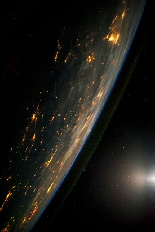
We have satellites in the sky, humans in orbit, and rovers on Mars. Very soon, we will be returning humankind to the Moon, and using it as a platform to travel to Mars and beyond.
And most importantly, we bring the universe to you.
What are your favorite NASA moments? We were only able to share a few of ours here, but if you want to learn about more important NASA milestones, check out 60 Moments in NASA History or our video, 60 Years in 60 Seconds.
Make sure to follow us on Tumblr for your regular dose of space: http://nasa.tumblr.com.
More Posts from Ocrim1967 and Others


Image Credit:NASA/JPL-Caltech
In this large celestial mosaic, our Spitzer Space Telescope captured a stellar family portrait! You can find infants, parents and grandparents of star-forming regions all in this generational photo. There’s a lot to see in this image, including multiple clusters of stars born from the same dense clumps of gas and dust – some older and more evolved than others. Dive deeper into its intricacies by visiting https://go.nasa.gov/2XpiWLf
Make sure to follow us on Tumblr for your regular dose of space: http://nasa.tumblr.com.
5 New Competitions for the Artemis Generation!
A common question we get is, “How can I work with NASA?”
The good news is—just in time for the back-to-school season—we have a slew of newly announced opportunities for citizen scientists and researchers in the academic community to take a shot at winning our prize competitions.
As we plan to land humans on the Moon by 2024 with our upcoming Artemis missions, we are urging students and universities to get involved and offer solutions to the challenges facing our path to the Moon and Mars. Here are five NASA competitions and contests waiting for your ideas on everything from innovative ways to drill for water on other planets to naming our next rover:
1. The BIG Idea Challenge: Studying Dark Regions on the Moon
Before astronauts step on the Moon again, we will study its surface to prepare for landing, living and exploring there. Although it is Earth’s closest neighbor, there is still much to learn about the Moon, particularly in the permanently shadowed regions in and near the polar regions.

Through the annual Breakthrough, Innovative and Game-changing (BIG) Idea Challenge, we’re asking undergraduate and graduate student teams to submit proposals for sample lunar payloads that can demonstrate technology systems needed to explore areas of the Moon that never see the light of day. Teams of up to 20 students and their faculty advisors are invited to propose unique solutions in response to one of the following areas:
• Exploration of permanently shadowed regions in lunar polar regions • Technologies to support in-situ resource utilization in these regions • Capabilities to explore and operate in permanently shadowed regions
Interested teams are encouraged to submit a Notice of Intent by September 27 in order to ensure an adequate number of reviewers and to be invited to participate in a Q&A session with the judges prior to the proposal deadline. Proposal and video submission are due by January 16, 2020.
2. RASC-AL 2020: New Concepts for the Moon and Mars
Although boots on the lunar surface by 2024 is step one in expanding our presence beyond low-Earth orbit, we’re also readying our science, technology and human exploration missions for a future on Mars.
The 2020 Revolutionary Aerospace Systems Concepts – Academic Linkage (RASC-AL) Competition is calling on undergraduate and graduate teams to develop new concepts that leverage innovations for both our Artemis program and future human missions to the Red Planet. This year’s competition branches beyond science and engineering with a theme dedicated to economic analysis of commercial opportunities in deep space.

Competition themes range from expanding on how we use current and future assets in cislunar space to designing systems and architectures for exploring the Moon and Mars. We’re seeking proposals that demonstrate originality and creativity in the areas of engineering and analysis and must address one of the five following themes: a south pole multi-purpose rover, the International Space Station as a Mars mission analog, short surface stay Mars mission, commercial cislunar space development and autonomous utilization and maintenance on the Gateway or Mars-class transportation.
The RASC-AL challenge is open to undergraduate and graduate students majoring in science, technology, engineering, or mathematics at an accredited U.S.-based university. Submissions are due by March 5, 2020 and must include a two-minute video and a detailed seven to nine-page proposal that presents novel and robust applications that address one of the themes and support expanding humanity’s ability to thrive beyond Earth.
3. The Space Robotics Challenge for Autonomous Rovers
Autonomous robots will help future astronauts during long-duration missions to other worlds by performing tedious, repetitive and even strenuous tasks. These robotic helpers will let crews focus on the more meticulous areas of exploring. To help achieve this, our Centennial Challenges initiative, along with Space Center Houston of Texas, opened the second phase of the Space Robotics Challenge. This virtual challenge aims to advance autonomous robotic operations for missions on the surface of distant planets or moons.

This new phase invites competitors 18 and older from the public, industry and academia to develop code for a team of virtual robots that will support a simulated in-situ resource utilization mission—meaning gathering and using materials found locally—on the Moon.
The deadline to submit registration forms is December 20.
4. Moon to Mars Ice & Prospecting Challenge to Design Hardware, Practice Drilling for Water on the Moon and Mars
A key ingredient for our human explorers staying anywhere other than Earth is water. One of the most crucial near-term plans for deep space exploration includes finding and using water to support a sustained presence on our nearest neighbor and on Mars.
To access and extract that water, NASA needs new technologies to mine through various layers of lunar and Martian dirt and into ice deposits we believe are buried beneath the surface. A special edition of the RASC-AL competition, the Moon to Mars Ice and Prospecting Challenge, seeks to advance critical capabilities needed on the surface of the Moon and Mars. The competition, now in its fourth iteration, asks eligible undergraduate and graduate student teams to design and build hardware that can identify, map and drill through a variety of subsurface layers, then extract water from an ice block in a simulated off-world test bed.
Interested teams are asked to submit a project plan detailing their proposed concept’s design and operations by November 14. Up to 10 teams will be selected and receive a development stipend. Over the course of six months teams will build and test their systems in preparation for a head-to-head competition at our Langley Research Center in June 2020.
5. Name the Mars 2020 Rover!
Red rover, red rover, send a name for Mars 2020 right over! We’re recruiting help from K-12 students nationwide to find a name for our next Mars rover mission.
The Mars 2020 rover is a 2,300-pound robotic scientist that will search for signs of past microbial life, characterize the planet’s climate and geology, collect samples for future return to Earth, and pave the way for human exploration of the Red Planet.
K-12 students in U.S. public, private and home schools can enter the Mars 2020 Name the Rover essay contest. One grand prize winner will name the rover and be invited to see the spacecraft launch in July 2020 from Cape Canaveral Air Force Station in Florida. To enter the contest, students must submit by November 1 their proposed rover name and a short essay, no more than 150 words, explaining why their proposed name should be chosen.
Just as the Apollo program inspired innovation in the 1960s and ‘70s, our push to the Moon and Mars is inspiring students—the Artemis generation—to solve the challenges for the next era of space exploration.
For more information on all of our open prizes and challenges, visit: https://www.nasa.gov/solve/explore_opportunities
Make sure to follow us on Tumblr for your regular dose of space: http://nasa.tumblr.com


Recommended Resource: The Names of God by Ken Hemphill


Couple goals


Ask Ethan: Is There A Fundamental Reason Why E = mc²?
“Einstein’s equation is amazingly elegant. But is its simplicity real or only apparent? Does E = mc² derive directly from an inherent equivalence between any mass’s energy and the square of the speed of light (which seems like a marvelous coincidence)? Or does the equation only exist because its terms are defined in a (conveniently) particular way?”
Quite arguably, Einstein’s E = mc² is the most famous equation in the entire world. And yet, it isn’t obvious why it had to be this way! Could there have been some other speed besides the speed of light that converts mass to energy? Could there have been a multiplicative constant out in front besides “1” to give the right answer? No, no there couldn’t. If energy and momentum are conserved, and particles have the energies and momenta that they do, there’s no other option.
Come learn, at last, why E = mc², and why simply no other alternative will do.
Greatest Hits — Craters We Love
Our solar system was built on impacts — some big, some small — some fast, some slow. This week, in honor of a possible newly-discovered large crater here on Earth, here’s a quick run through of some of the more intriguing impacts across our solar system.
1. Mercury: A Basin Bigger Than Texas

Mercury does not have a thick atmosphere to protect it from space debris. The small planet is riddled with craters, but none as spectacular as the Caloris Basin. “Basin” is what geologists call craters larger than about 186 miles (300 kilometers) in diameter. Caloris is about 950 miles (1,525 kilometers) across and is ringed by mile-high mountains.
For scale, the state of Texas is 773 miles (1,244 kilometers) wide from east to west.
2. Venus: Tough on Space Rocks

Venus’ ultra-thick atmosphere finishes off most meteors before they reach the surface. The planet’s volcanic history has erased many of its craters, but like almost any place with solid ground in our solar system, there are still impact scars to be found. Most of what we know of Venus’ craters comes from radar images provided by orbiting spacecraft, such as NASA’s Magellan.
Mead Crater is the largest known impact site on Venus. It is about 170 miles (275 kilometers) in diameter. The relatively-flat, brighter inner floor of the crater indicates it was filled with impact melt and/or lava.
3. Earth: Still Craters After All These Years

Evidence of really big impacts — such as Arizona’s Meteor Crater — are harder to find on Earth. The impact history of our home world has largely been erased by weather and water or buried under lava, rock or ice. Nonetheless, we still find new giant craters occasionally.
A NASA glaciologist has discovered a possible impact crater buried under more than a mile of ice in northwest Greenland.
This follows the finding, announced in November 2018, of a 19-mile (31-kilometer) wide crater beneath Hiawatha Glacier – the first meteorite impact crater ever discovered under Earth’s ice sheets.
If the second crater, which has a width of over 22 miles (35 kilometers), is ultimately confirmed as the result of a meteorite impact, it will be the 22nd largest impact crater found on Earth.
4. Moon: Our Cratered Companion

Want to imagine what Earth might look like without its protective atmosphere, weather, water and other crater-erasing features? Look up at the Moon. The Moon’s pockmarked face offers what may be humanity’s most familiar view of impact craters.
One of the easiest to spot is Tycho, the tight circle and bright, radiating splat are easy slightly off center on the lower-left side of the full moon. Closer views of the 53-mile (85 kilometer)-wide crater from orbiting spacecraft reveal a beautiful central peak, topped with an intriguing boulder that would fill about half of a typical city block.
5. Mars: Still Taking Hits

Mars has just enough atmosphere to ensure nail-biting spacecraft landings, but not enough to prevent regular hits from falling space rocks. This dark splat on the Martian south pole is less than a year old, having formed between July and September 2018. The two-toned blast pattern tells a geologic story. The larger, lighter-colored blast pattern could be the result of scouring by winds from the impact shockwave on ice. The darker-colored inner blast pattern is because the impactor penetrated the thin ice layer, blasting the dark sand underneath in all directions.
6. Ceres: What Lies Beneath

The bright spots in Ceres’ Occator crater intrigued the world from the moment the approaching Dawn spacecraft first photographed it in 2015. Closer inspection from orbit revealed the spots to be the most visible example of hundreds of bright, salty deposits that decorate the dwarf planet like a smattering of diamonds. The science behind these bright spots is even more compelling: they are mainly sodium carbonate and ammonium chloride that somehow made their way to the surface in a slushy brine from within or below the crust. Thanks to Dawn, scientists have a better sense of how these reflective areas formed and changed over time — processes indicative of an active, evolving world.
7. Comet Tempel 1: We Did It!

Scientists have long known we can learn a lot from impact craters — so, in 2005, they made one themselves and watched it happen.
On July 4, 2005, NASA’s Deep Impact spacecraft trained its instruments on an 816-pound (370-kilogram) copper impactor as it smashed into comet Tempel 1.
One of the more surprising findings: The comet has a loose, “fluffy” structure, held together by gravity and contains a surprising amount of organic compounds that are part of the basic building blocks of life.
8. Mimas: May the 4th Be With You

Few Star Wars fans — us included — can resist Obi Wan Kenobi’s memorable line “That’s no moon…” when images of Saturn’s moon Mimas pop up on a screen. Despite its Death Star-like appearance, Mimas is most definitely a moon. Our Cassini spacecraft checked, a lot — and the superlaser-looking depression is simply an 81-mile (130-kilometer) wide crater named for the moon’s discoverer, William Herschel.
9. Europa: Say What?

The Welsh name of this crater on Jupiter’s ocean moon Europa looks like a tongue-twister, but it is easiest pronounced as “pool.” Pwyll is thought to be one of the youngest features we know of on Europa. The bright splat from the impact extends more than 600 miles (about 1,000 kilometers) around the crater, a fresh blanket over rugged, older terrain. “Fresh,” or young, is a relative term in geology; the crater and its rays are likely millions of years old.
10. Show Us Your Greatest Hits

Got a passion for Stickney, the dominant bowl-shaped crater on one end of Mars’ moon Phobos? Or a fondness for the sponge-like abundance of impacts on Saturn’s battered moon Hyperion (pictured)? There are countless craters to choose from. Share your favorites with us on Twitter, Instagram and Facebook.
Make sure to follow us on Tumblr for your regular dose of space: http://nasa.tumblr.com


The galaxy is perfect


This Is Everything That’s Wrong With Our Definition Of ‘Planet’
“There are many people who would love to see Pluto regain its planetary status, and there’s a part of me that grew up with planetary Pluto that’s extraordinarily sympathetic to that perspective. But including Pluto as a planet necessarily results in a Solar System with far more than nine planets. Pluto is only the 8th largest non-planet in our Solar System, and is clearly a larger-than-average but otherwise typical member of the Kuiper belt. It will never be the 9th planet again.
But that’s not necessarily a bad thing. We may be headed towards a world where astronomers and planetary scientists work with very different definitions of what attains planethood, but we all study the same objects in the same Universe. Whatever we call objects — however we choose to classify them — makes them no less interesting or worthy of study. The cosmos simply exists as it is. It’s up to the very human endeavor of science to make sense of it all.”
Next month will mark 13 years since the International Astronomical Union (IAU) officially defined the term planet and ‘Plutoed’ our Solar System’s (up-until-that-point) 9th planet. With an additional 13 years of knowledge, understanding, data, and discoveries, though, did they get the decision right?
Certainly, there were aspects that needed to be revised, but the IAU’s definition comes along with some major gaps and mistakes. We can do better! Come learn how.
Hurricanes Have No Place to Hide, Thanks to Better Satellite Forecasts

If you’ve ever looked at a hurricane forecast, you’re probably familiar with “cones of uncertainty,” the funnel-shaped maps showing a hurricane’s predicted path. Thirty years ago, a hurricane forecast five days before it made landfall might have a cone of uncertainty covering most of the East Coast. The result? A great deal of uncertainty about who should evacuate, where it was safe to go, and where to station emergency responders and their equipment.

Over the years, hurricane forecasters have succeeded in shrinking the cone of uncertainty for hurricane tracks, with the help of data from satellites. Polar-orbiting satellites, which fly nearly directly above the North and South Poles, are especially important in helping cut down on forecast error.

The orbiting electronic eyeballs key to these improvements: the Joint Polar Satellite System (JPSS) fleet. A collaborative effort between NOAA and NASA, the satellites circle Earth, taking crucial measurements that inform the global, regional and specialized forecast models that have been so critical to hurricane track forecasts.

The forecast successes keep rolling in. From Hurricanes Harvey, Irma and Maria in 2017 through Hurricanes Florence and Michael in 2018, improved forecasts helped manage coastlines, which translated into countless lives and property saved. In September 2018, with the help of this data, forecasters knew a week ahead of time where and when Hurricane Florence would hit. Early warnings were precise enough that emergency planners could order evacuations in time — with minimal road clogging. The evacuations that did not have to take place, where residents remained safe from the hurricane’s fury, were equally valuable.

The satellite benefits come even after the storms make landfall. Using satellite data, scientists and forecasters monitor flooding and even power outages. Satellite imagery helped track power outages in Puerto Rico after Hurricane Maria and in the Key West area after Hurricane Irma, which gave relief workers information about where the power grid was restored – and which regions still lacked electricity.

Flood maps showed the huge extent of flooding from Hurricane Harvey and were used for weeks after the storm to monitor changes and speed up recovery decisions and the deployment of aid and relief teams.

As the 2019 Atlantic hurricane season kicks off, the JPSS satellites, NOAA-20 and Suomi-NPP, are ready to track hurricanes and tropical cyclones as they form, intensify and travel across the ocean – our eyes in the sky for severe storms.
For more about JPSS, follow @JPSSProgram on Twitter and facebook.com/JPSS.Program, or @NOAASatellites on Twitter and facebook.com/NOAASatellites.
Make sure to follow us on Tumblr for your regular dose of space: http://nasa.tumblr.com.
I love baby huskies ❤️


-
 rubymayyys-blog liked this · 3 months ago
 -
 dutifullydecaffeinatedtaco liked this · 11 months ago
 -
 prinecetblatin liked this · 1 year ago
 -
 oihvgci liked this · 1 year ago
 -
 anaiscova liked this · 1 year ago
 -
 pleby64potato liked this · 2 years ago
 -
 bigpoppadean liked this · 2 years ago
 -
 coksesvarr liked this · 4 years ago
 -
 anna-kendrxck liked this · 4 years ago
 -
 createdpetty liked this · 4 years ago
 -
 pink-catnip liked this · 4 years ago
 -
 justatheatrekidwholovesspace liked this · 4 years ago
 -
 josefksapartment liked this · 4 years ago
